Zimrathâni and Pel
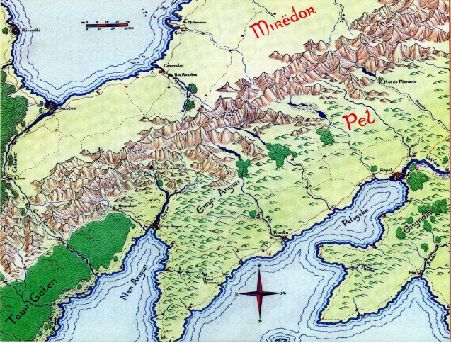
Zimrathâni (Av. "Merindori", Q. "Mîrenórë"), the "Jewel-land," was situated north of the Yellow Mountains and south of the Bay of Drel. Bound by the river Celiant to the west, the Onpu Mispír to the north, and the Sîresham to the east, it was an astoundingly flat coastal plateau occupied by Apysaic-speaking Aden and Drêl tribes. (The urbane Adena comprised the majority).

Zimrathâni as a whole
Regions[]
Elornan Cut Fields of Pharazâin Silverbridge Pass Tontiur Trenth Walk
Places of Note[]
Alsarias Arig's Tomb Bar Araphor Fal Carth Gar House of the Black Hand Karasalas Látor Malmoadian Naragul Gimileth Ró-mollo Silverbridge Pass
Characters[]
Notes[]
Mirëdor seems to be a corrupt form of the Quenya name Mîrënóre, maybe a topographical name scholars of the Elendili used in old maps.
While the name may have been used by its first ruler, Arvarien, who spoke Sindarin and Quenya, it would have been known in Adunaic from the third millenium of the Second Age onwards due to the animosity of the Kingsmen for use of the elven tongues. Zimrathâni however is the correct translation of Jewel-Land into Adûnaic.
References[]
- MERP.com Wiki
- the Wild Lands south and East, Gazetteer by Pete Fenlon